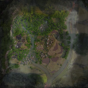
An Lao Valley
| Thung lũng An Lão | |||||||||||
| An Lao Valley | |||||||||||

| |||||||||||
The United States Forces and the People's Army of Vietnam engage in major-scale battle around a US firebase in a valley, involving the combined forces of both conventional and guerrilla warfare in efforts of capturing and defending significant objectives and positions.
History
History Here
Map Details
Supremacy
Objectives:
- A. Base Area 226 (3 Points, PAVN HQ) → B
- B. North Village (2 Points) → C, D
- C. Radio Relay Station (5 Points) → B, E
- D. Montagnard Village (3 Points) → B, E
- E. South Village (2 Points) → D, F
- F. River Outpost (3 Points, US Army HQ) → E
| Faction | Tickets |
|---|---|
| People's Army of Vietnam | 634 |
| United States Army | 634 |
| Time | |
| 40 Minutes |
Territories
Objectives:
- A. North Village
- B. Montagnard Village
- C. South Village
- D. River Outpost
- E. Radio Relay Station
| Faction | Tickets | Role |
|---|---|---|
| People's Army of Vietnam | 734 | Attacking |
| United States Marine Corps | 684 | Defending |
| Time | ||
| 40 Minutes | ||
Trivia
- Based on the real An Lao Valley in Vietnam. However, the US was only involved in operations there in 1966, whereas the map likely takes place in the late '60s based on the weapons available, so the battle itself is fictionalized, even though the terrain is not as confirmed by the developers.
Gallery
Lorem ipsum dolor sit amet, consectetur adipiscing elit, sed do eiusmod tempor incididunt ut labore et dolore magna aliqua. Ut enim ad minim veniam, quis nostrud exercitation ullamco laboris nisi ut aliquip ex ea commodo consequat. Duis aute irure dolor in reprehenderit in voluptate velit esse cillum dolore eu fugiat nulla pariatur. Excepteur sint occaecat cupidatat non proident, sunt in culpa qui officia deserunt mollit anim id est laborum